
SLACKERS HILL
- David Gainey

- Oct 10, 2020
- 4 min read
Updated: Apr 12, 2021
I was going to title this post The Best Trail Run In The World because it’s just that good, but then I started thinking about all the other great trail runs just in the San Francisco Bay Area, and realized that there are probably some pretty great trail runs in the Continental Divide, the Alps, and lots and lots of other places, too. So I downgraded the title to better manage expectations. The name “Slackers Hill” may conjure up visions of a hands-in-his-pockets Richard Linklater character, but don’t be fooled; this route is not for couch potatoes. It’s a doable, accessible little run that’s packed with just the right amount of vertical, some drama and shockingly great views.

While it is possible to start your adventure from either of the two Golden Gate parking areas on the north side of the bridge, I’ve been scared off by the many strategically placed and highly visible signs that read, “PREVENT THEFT - DO NOT LEAVE VALUABLES IN VEHICLE”. Typically, I’ll pass the lot entrances and drive toward Sausalito for a little over a mile, parking on East Road on the way to Fort Baker. It feels like the area is less prone to break-ins, parking is convenient, and the route adds some good distance and places of interest.
Running from the car, you’ll follow a roadside dirt path to the main fort complex, passing the Bay Area Discovery Museum and turning left after the U.S. Coast Guard Station. It’s impossible to get lost at this point. Aim for the most magnificent bridge you’ve ever seen. Follow the pavement to the right under the bridge and you’ll find yourself on Conzelman Road, a slightly steep, short access path leading to North Tower Golden Gate Parking at road level on the west side of Highway 101.
From this small parking lot, you leave the pavement behind and step into the wild on the SCA (Student Conservation Association) Trail. The climb up Conzelman Road and the initial switchbacks on the trail may leave you wondering if this is too much climb for an average runner, but rest assured that the most challenging section is nearly behind you. Any huffing and puffing you are doing at this moment will dissolve into full breaths, more manageable terrain and breathtaking views. Sure, there are a few more steep pitches, but you’ve got this.

It’s usually at some point along this narrow, snaking, single-track climb that I think of the countless tourists in the rest area below. If they could take just thirty minutes away from that double decker bus to hike part way up this trail, they would witness the bridge from a completely different vantage point, seeing it in a broader, more beautiful multi-scape of ocean, coastal range, bay, and city. I feel for those tourists. Heck, I’ve been those tourists. But I’m not looking to proselytize and I’m not looking for company. This is my own (mostly) private trail, today, and the solitude is good for the soul.
At the crest of the east facing hill you hit a crossroads. Hang a left on the Coastal Trail and climb to a view of the Marin Headlands, with the expanse of Rodeo Valley before you and Rodeo Beach to the west-northwest. After a short downhill, make a hard left again at the first major trail crossing and you’ll be striding your way on a spur trail to the 930 foot summit of Slackers Hill.
You’ve arrived.
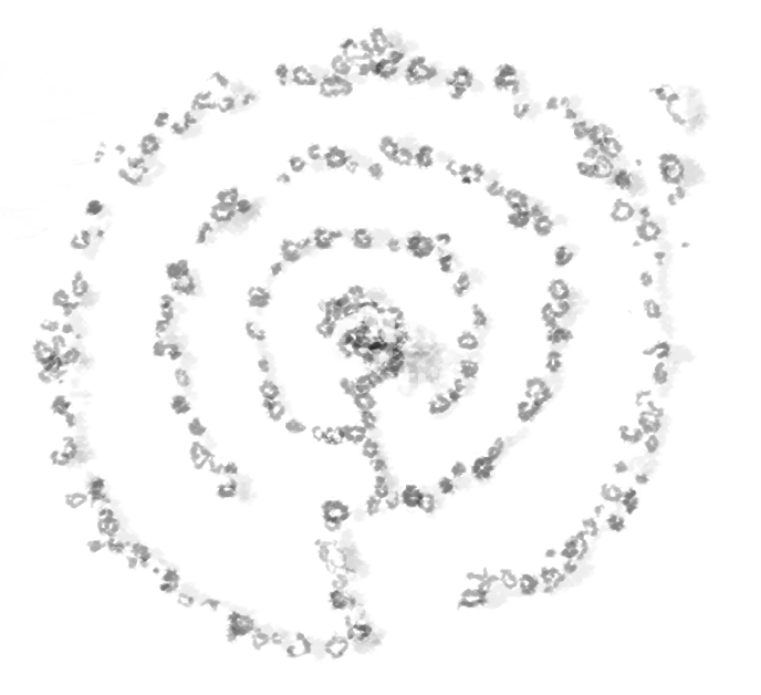
Drink in the sights from this 360 degree lookout (yes, you need to visit on a fogless day), and gulp down your own Gatorade or water. You won’t find any
facilities on this stark, spiritual spot. When I first ran this route several years ago, I guessed that the views would be great from the ridgeline, but I didn’t really think about what else I’d find on Slackers Hill. So it was with great joy that I discovered such a wonderful surprise. There in the flat clearing of the summit was a hand-placed, small stone labyrinth, with a living bush at the center. After the bustle of the bridge and an epic, adventurous run at the limits of my own experience, I’d discovered this silent, circuitous, walk to the center.
The run back is fun. Relaxing and fast. Careful to keep your eyes and feet on the trail, though! It’s easy to get distracted by all the aforementioned wonders and a tumble down the hill would put a damper on an otherwise uplifting outing. A full route through the Vista Point rest area and down Alexander Avenue to your parked car will be about six and a half miles. An alternate route directly from one of the parking areas would likely be a three mile round trip. And other options for longer runs and variety abound: explore other parts of the Marin Headlands, take a detour across the bridge, itself, or run to downtown Sausalito and grab a hard-earned ice cream.
Do you think there is a better way to spend a morning, midday, or afternoon?
I think not.

Comments